KAY COUNTY EMERGENCY MAINTENANCE
UPDATED 915am –
NATIONAL WEATHER SERVICE
UPDATED 1045am – we just did a briefing for close to 400 of our emergency management and television partners.
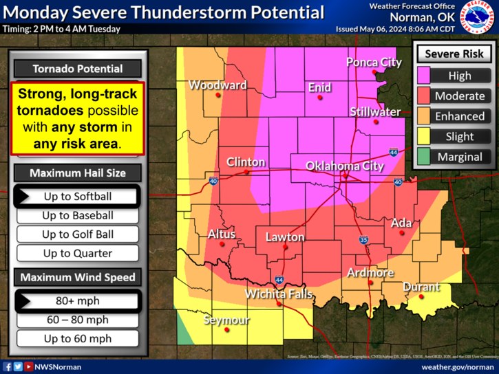
– DO NOT FOCUS ON THE RISK CATEGORIES! It does not matter what category, color or number area you are in today. EVERY storm will be equally capable of producing dangerous tornadoes and destructive hail.
– Many (most?) people will NOT see any storms at all! We are only expecting a small number of storms. We could have 2-3, we could have 10. The thing to remember is if you see a storm near you, assume it’s a dangerous storm.
– We have not experienced a day like this in quite some time. We expect storms to become supercells quickly after they form, and they should remain supercells through the event. We do not expect them to form into a squall line or cluster.
– The potential for tornadoes will INCREASE after dark, so do not let your guard down. Wind shear – which is already plenty for tornadoes this afternoon – will only become more favorable after dark. This is important!
– Clouds will NOT prevent storms from forming today or lessen their severity.
– The cap (a layer of warm air above the surface) will NOT prevent storms from forming today.
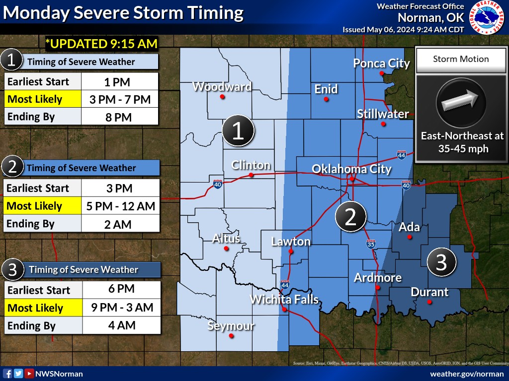
– The timing graphic has our best analysis of when we think severe storms are most likely in your area. Please use this as a tool to help you make decisions about closings, cancellations, etc. Call us if you need more specific guidance. REMEMBER – many locations won’t see a storm, but if you do, it will be bad.
IMPORTANT! please check the weather before you get in your vehicle this afternoon to leave work or school. If there are storms nearby, consider delaying your trip!
Here are some additional Severe Storm articles.


