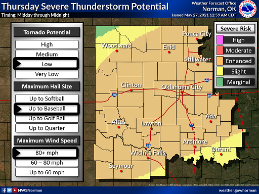
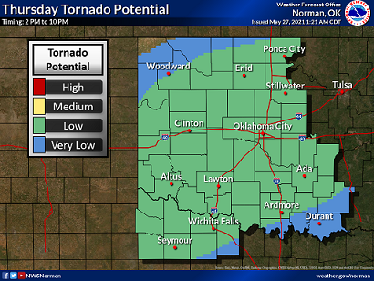
The National Weather Service in Norman has placed Kay County and much of Oklahoma under an enhanced risk for severe weather for Thursday.
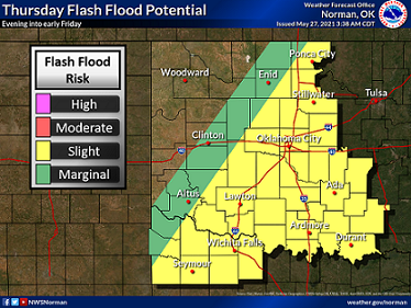
The weather service says there’s the threat for hail up to the size of baseball, winds as high as 80 mph and a low tornado threat. There is also a slight flooding risk.
Accord to the Storm Prediction Center, Latest radar data continues to indicate lingering convection along the KS/OK border as well as over the eastern TX Panhandle. It’s not entirely clear how much of this convection will be present at daybreak. Several HREF members suggest at minimum there will be left over convective debris, or more likely some weak convection at 12z.
This activity would likely propagate east and possibly reintensify as boundary-layer heating reduces CINH by early afternoon. If convection is not too disruptive, then a more buoyant air mass may advance into southeastern KS/southwestern MO; however, the most likely area for strong instability will remain across the southern Plains. This is the most concerning portion of the outlook as thunderstorms will develop along the early-day outflow boundaries, dryline, and synoptic front.
While low-level flow should veer a bit into the southwest across this region, adequate turning/bulk shear will be present for supercells. Have lowered the tornado probabilities a bit across this region but not due to the lack of buoyancy/shear. At this time there is too much uncertainty regarding the evolution of the early-day convection and the possibility for disrupting cold pool.
When these boundaries are identified later today there may be a region where higher potential for a few tornadoes can be addressed. Otherwise, severe thunderstorms will develop across a large corridor from the TX South Plains, through OK into MO.
Very large hail will be noted across the southern Plains with supercells and upscale growth into an MCS is possible by early evening. If an MCS does evolve, damaging winds would become a legitimate concern as this activity propagates toward the Red River.
Be sure to have a way to receive alerts throughout the day, make sure your phone is charged and that you have a place to take shelter if needed.
Listen for Dan Holiday every hour in the Ponca City Specialty Clinic Weather Center on 104.7 The Bull and 1230 WBBZ for the latest information every hour.
Posted below are graphics from the National Weather Service in Norman.


