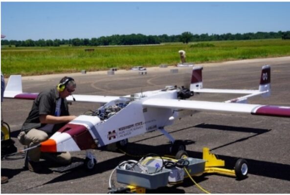
From November 6 to 18, 2021, a series of uncrewed aerial system (UAS) test flights left the Blackwell Tonkawa Municipal Airport (BKN) to test meteorological sampling instruments, designed to help make better weather forecasts.
The flights, led by Mississippi State University’s Raspet Flight Research Laboratory, will operate at low altitudes and low speed.
As a result, the UAS may be heard and observed by the public as they fly directly to and from the Southern Great Plains (SGP) atmospheric observatory (operated by the U.S. Department of Energy’s Atmospheric Radiation Measurement [ARM] user facility).
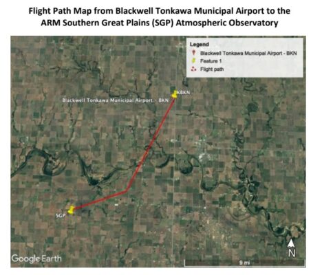
The flight path from the airport and the SGP site is approximately 13 miles (see flight path map on the next page), so Raspet and ARM officials worked with farmers and landowners to make them aware of the flights and to secure permissions to position staggered visual observers (people) on the ground who will track the UAS flights.
Between the airport and the SGP site, UAS flew at about 1,000 feet above ground level at a cruise speed of 63 miles per hour. The goal of the testing is to ensure safety and ultimately receive Federal Aviation Administration (FAA) certification for UAS flight operations beyond visual line of sight.
The flights tested instrumentation installed on the UAS that collect meteorological samples— humidity, temperature, cloud composition, trace
gases, aerosols (tiny particles such as dust), and surface properties.
These flights allowed Raspet and ARM engineers to test instrument configuration in a real-world environment and its effect on flight characteristics and performance. UAS operations can lead to better meteorological forecasts and better modeling of long-term weather patterns.


