Information provided by the National Weather Service Office in Norman:
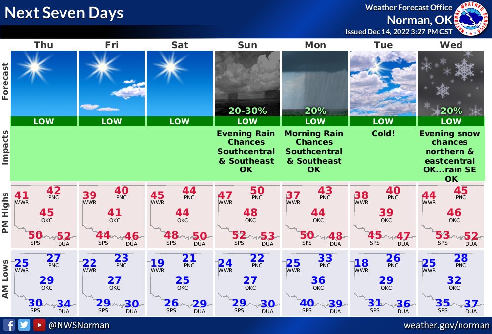
Our forecast is still pretty much on track although some areas could see some snow by the middle of next week (we only go out 7-days). Unseasonably cooler temperatures will continue into the weekend.
South winds return on Sunday bringing in relatively warmer air, as Sunday will be our warmest day in the forecast, with temperatures only rising “to average.”
Two strong cold fronts will come through next week, one on Monday night and the second one on Thursday. Very cold Canadian-based air will be coming through behind these fronts with temperatures plunging and more winterlike.
Prior to Thursday’s front, another mid-level disturbance coming in from the west could produce some snow across portions of northern & east central Oklahoma (see graphic below) with a “cold rain” again across southeast Oklahoma. Of course, Wednesday night precipitation may and is likely to change as we get closer in time. One thing for sure, it’s going to be much colder all next week.


