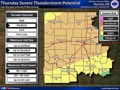
The National Weather Service has put out an enhanced risk for severe weather on Thursday that includes much of central and northern Oklahoma, southern and southeastern Kansas, northwest Arkansas and central and southern Missouri.
Scattered severe thunderstorms are likely on Thursday and Thursday night from parts of the southern Great Plains into the Ozarks and middle Mississippi Valley. Very large hail, significant severe gusts, and several tornadoes are possible.
FOR THE KANSAS/OKLAHOMA AREA
To the south of morning showers/storms over the lower MO Valley, a very moist airmass (15-17 g/kg lowest 100 mb mean mixing ratios) will become very to extremely unstable (3000-4500 J/kg MLCAPE) by mid afternoon, south of an outflow boundary and cool front.
Strong heating near the front and outflow boundary will likely be preferable locations for thunderstorm development by mid-late afternoon. Forecast soundings show ample deep-layer shear favoring organized storms (e.g., supercells) with large CAPE in the -10 to -30 deg C layer. Large to giant hail is possible with the early discrete supercell activity.
Although low-level shear is modest, a tornado risk may focus near a potential outflow boundary or perhaps where SRH may be maximized (per stronger 850-700 mb flow) during the early evening over northeast OK into southeast KS. Scattered to numerous thunderstorms are forecast to eventually develop near the front from the eastern TX Panhandle into northwest OK and east along the KS/OK border.
Consolidation into one or more surging bows may occur during the evening and persist into the overnight. Significant severe gusts may accompany the stronger supercell to squall line transition process or with embedded mesovortices within a moist low-level airmass centered over central/eastern OK.
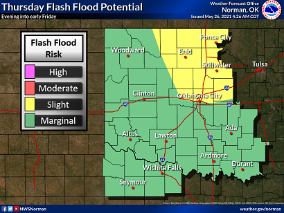
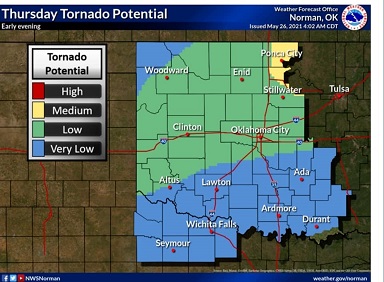
The National Weather Service in Norman shared these following graphics Wednesday morning. These could change over the next 24 hours. There is a Medium tornado risk for parts of Kay and Noble counties. There’s also a slight flood risk for the area.


